Still excellent results for RUIDE Nova R6 GNSS receivers, this time engaged in airport measurements.
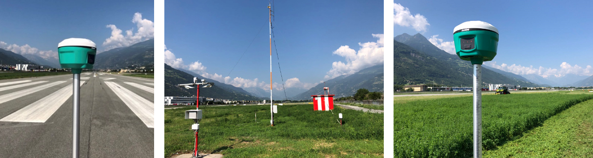
The ILS (Instrument Landing System) guides aircraft with high precision in the final phase of instrumental approach. The radio signals that allow the system to operate in safety are emitted by a complex system of antennas positioned near the runway: their positioning is carefully studied by a software which requires, among the numerous input data, also the plano-altimetric characterization (model) of the land surrounding the plant.
Thanks to Ruide Nova R6 and Carlson SurvPC technology, Thales Group technicians have verified how the efficiency of the GNSS positioning systems is immediately available also for the “non surveyors” thanks to the intuitive software platform.
The survey and stakeout functions available in Carlson SurvPC allowed the definition of a digital elevation model (DEM) with few and simple settings directly in the field.
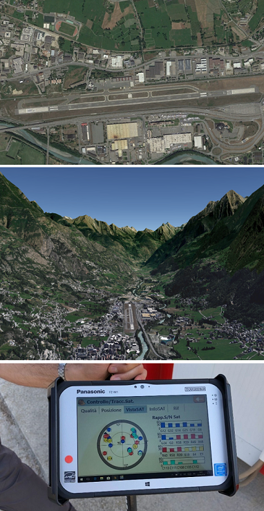
Interesting, for the purposes of evaluating the performance of the GNSS receiver RUIDE Nova R6, the orographic context in which the airport “Corrado Gex” (built in the late fifties) is located:
This measurement activity had the purpose of determining the positioning of the “Shelters” of the RF control and transmission equipment, of the light approaching systems and the survey and calculation of the model of the ground with regular meshes, to be inserted in the software of simulation of operation of antennas.
In N-RTK mode the GNSS RUIDE Nova R6 ensured altimetric accuracy around 13/18 mm for the entire duration of the test, while operating with connection to the “Spin GNSS” network (Piedmont / Lombardy interregional network) instead of the more nearby “GNSS VDA” network.
In configuration base + rover, accuracy is further improved, reaching an elevation of about 6 mm thanks to the presence, in the survey session, of 5 Galileo satellites and 3 Beidou satellites.