
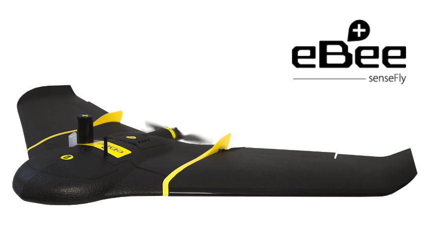

Caratteristiche principali
- Wingspan 110 cm
- Weight 1,1 kg
- Camera S.O.D.A.
- Maximum flight time up to 59 minutes
- Radio link range: 3km nominal (up to 8km)
- Cruise speed 40-110 km/h
- WInd resistance up to 45km/h
- Linear Landing
- Ground control points (GCPs) required: No (RTK/PPK activated), optional (RTK/PPK unactivated)
The senseFly eBee Plus survey drone is a large-coverage photogrammetric mapping system featuring RTK/PPK upgradeability, for survey-grade accuracy on demand.
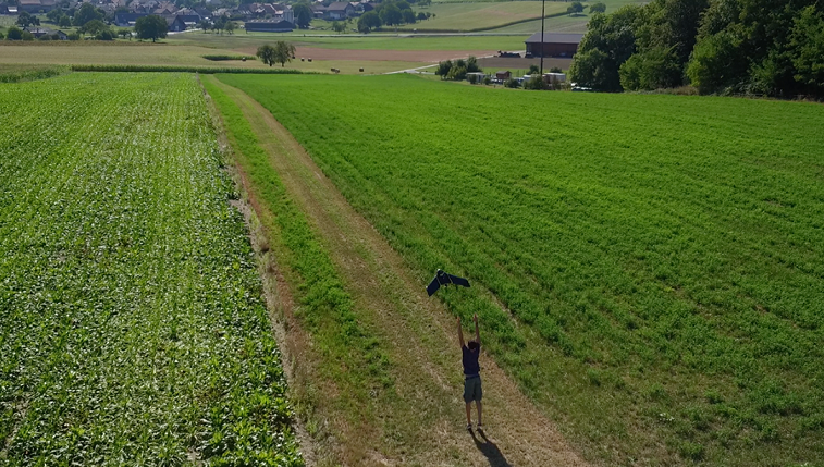
The senseFly eBee Plus, with a single flight mission, can map larger areas than any other drone in its weight class, allowing you to maximize your efficiency by optimizing the number of flights to be performed.
Max time flight up to 59 minutes.
senseFly eBee Plus is equipped with senseFly S.O.D.A. that is the first camera designed designed for photogrammetric drone mapping.
The senseFly eBee Plus is a uniquely flexible tool. It is available with multiple camera payloads (professional-grade RGB, thermal infrared, multispectral) so you need only invest in the configuration that suits your business’ needs.
Includes eMotion 3: senseFly eMotion 3 is a next-generation software for drone flight & data management. It includes: mission block flight planning, efficient multi-flight missions, a full 3D control environment, multiple payload support, cloud connectivity & more